
Lincoln Avenue
Virtual Walking Tour
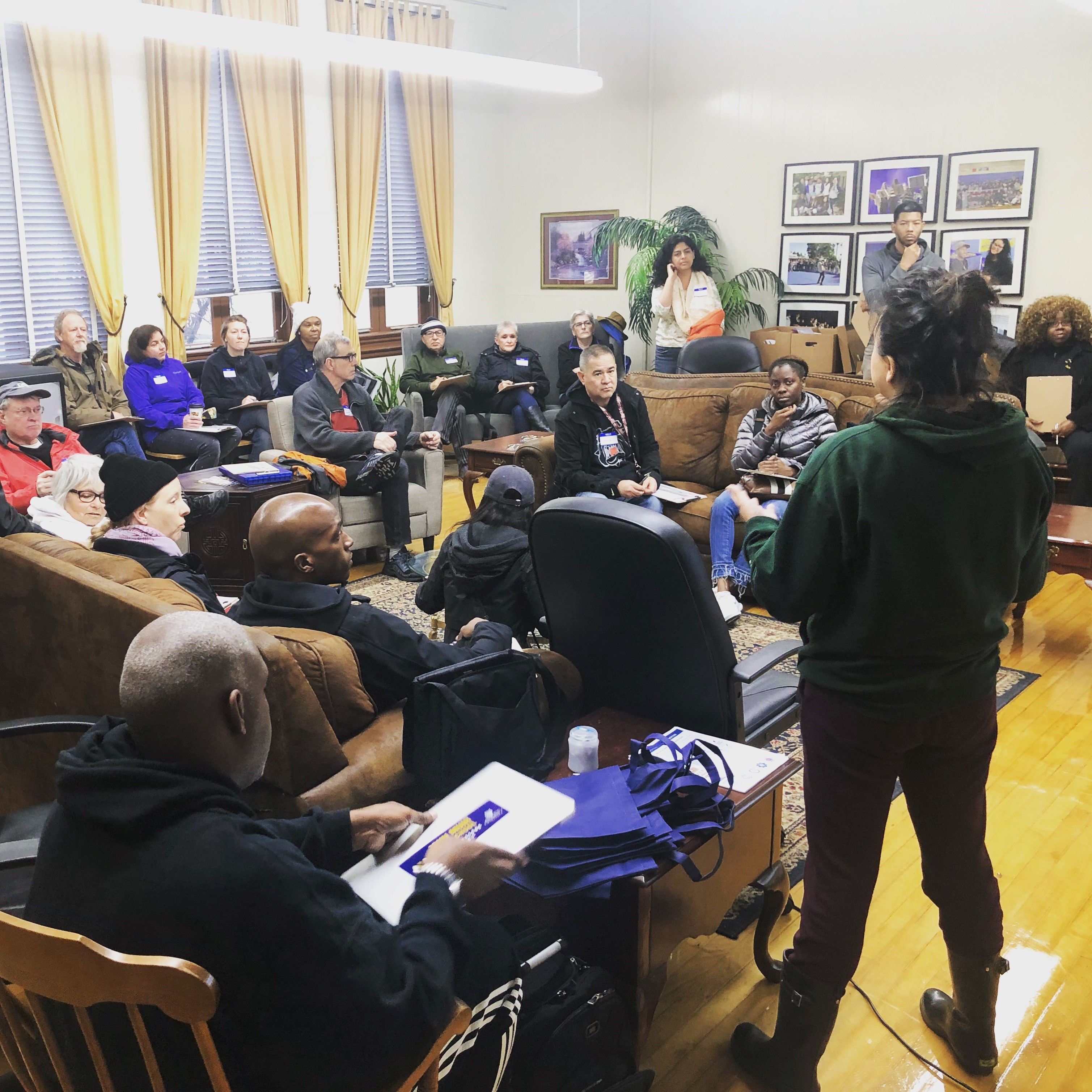 Due to heavy rains, staff held a "virtual" walking tour inside John Muir High School..
The Planning & Community Development Department along with Council District 1 Councilmember Hampton hosted a virtual walking tour of the Lincoln Avenue Specific Plan area, asking participants about opportunities to improve the walking environment, and what types of uses should be introduced, preserved, or removed.
Walking Tour Agenda
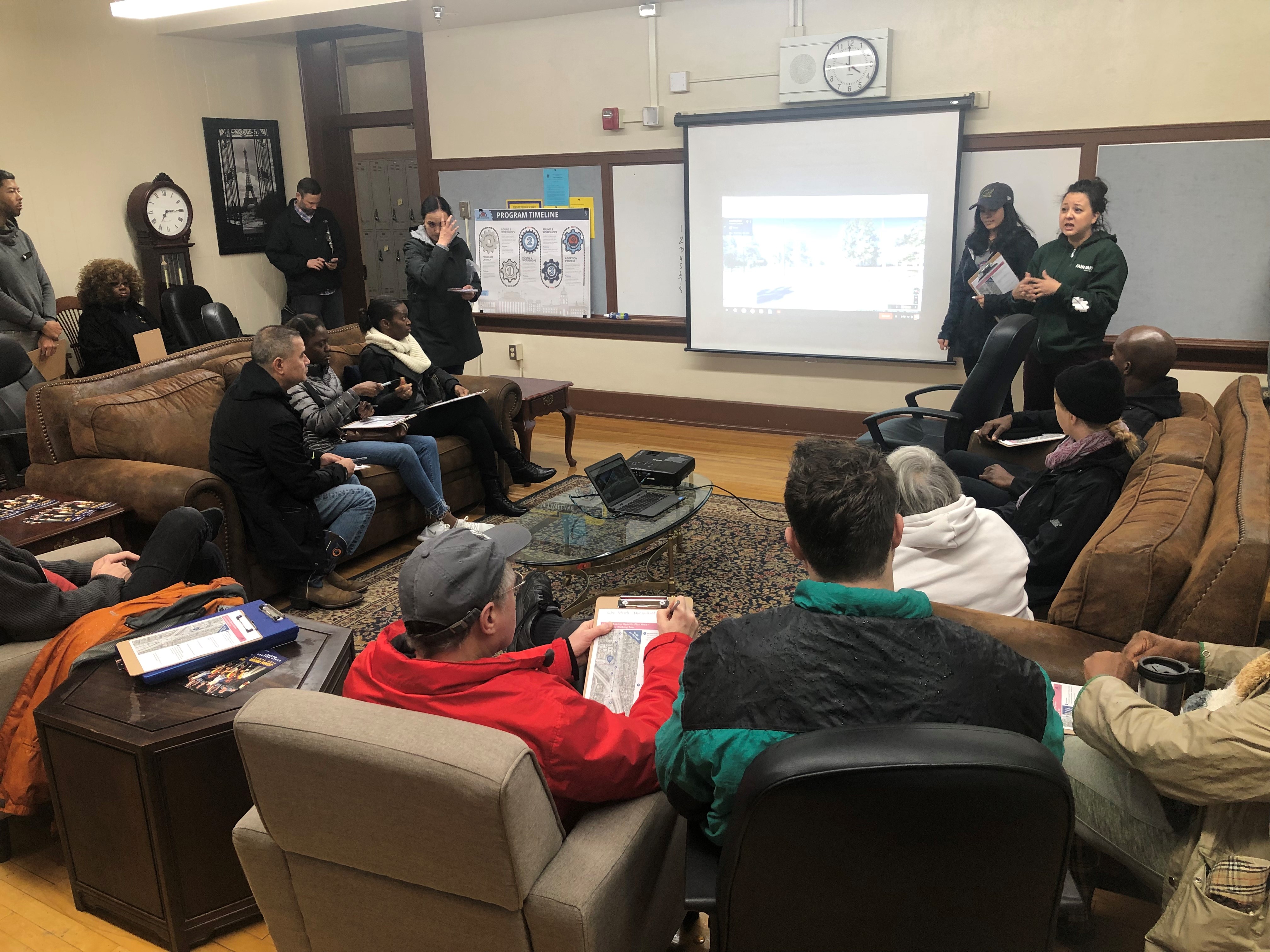 Google maps, street view enabled participants to "walk" through the planned route.
Due to heavy rains, the tour was held inside John Muir High School where Google Maps, Street View enabled participants to explore the intended route of the walking tour. The tour began at the intersection of Wyoming and Lincoln and ended at John Muir High School. Participants wrote comments on walking tour worksheets/guides as staff navigated Google Street View through portions of Lincoln Avenue. At the end of the tour, participants identified specific locations on large maps with image cards depicting desired uses.
What We Heard
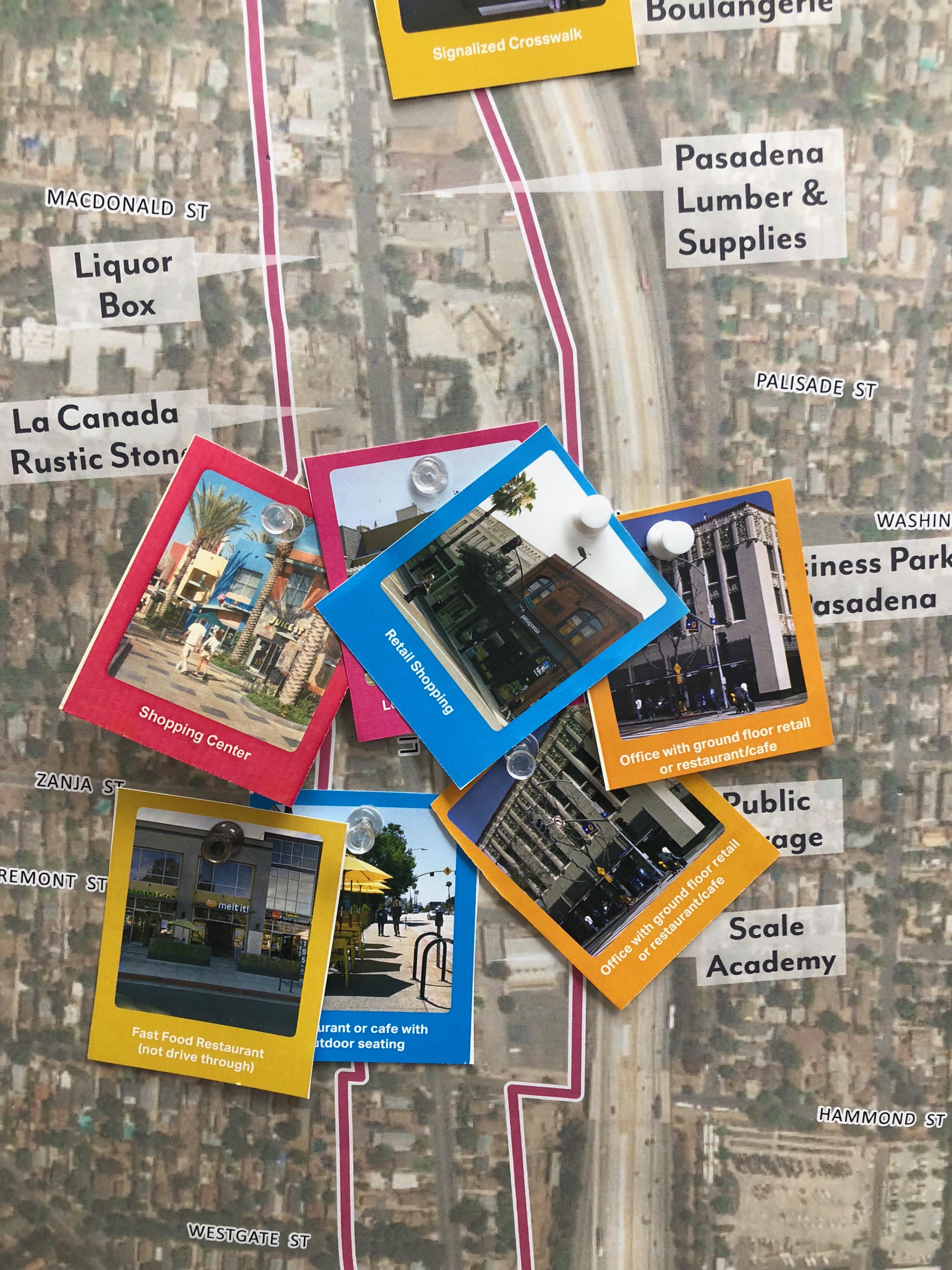 The walking tour concluded with an interactive mapping exercise held at the John Muir High School.
Approximately 20 community members attended the virtual walking tour and provided feedback on the future of Lincoln Avenue. The following represents major themes that emerged during the tour.
- Preference for low to mid-rise development, with lower scale buildings north of Wyoming Street
- Desire to maintain existing multi-family housing near Idaho and Claremont Streets
- General support for mixed-use development, housing over commercial, near Washington Boulevard
- Consider regulating the design of new residential fences near Muir High School
- Desire for more affordable housing throughout the plan area
- In favor of maintaining the existing lower-scale commercial character, particularly north of Wyoming Street
- Desire to maintain existing multi-family housing near Idaho and Claremont Streets
- General preference to maintain existing light industrial and auto-oriented uses for future employment opportunities and services, south of Washtington Boulevard
- Consider limiting new light industrial and auto-oriented businesses in the future and/or require new businesses to make improvements, such as adding more landscaping
- Interest in more outdoor seating, open space plazas, and landscaping
- More sidewalk improvements, including street trees
- Support for lighting and artwork to brighten up the 210-freeway underpass to improve safety and walkability
- Traffic and safety concerns at key intersections of the plan area identified at Wyoming Avenue, Montana Street, Howard Avenue, and Hammond Avenue
- Gerenal support for parking adjustments in order to encourage new desired uses